Off the coasts of Northern California, Oregon, Washington, and British Columbia lies a 600-mile geological fault that’s been ominously quiet for over 300 years. This is the Cascadia Subduction Zone, where the smaller Juan de Fuca Plate pushes beneath the North American Plate. Instead of sliding smoothly, the plates are locked. Strain builds year after year. And when it finally snaps, Cascadia could deliver a magnitude 9.0 or greater megathrust earthquake.
Geological records and Native oral histories point to the last massive rupture in 1700. Coastal marshes preserve ghost forests—cedar stumps drowned by seawater after the ground suddenly dropped. That quake also triggered a tsunami recorded in Japan. Scientists now estimate the 1700 event reached magnitude 9.0 and ruptured the full fault line.
The odds of a repeat in the next 50 years? Roughly 15 percent. And if it hits, it could bring devastation. The shaking alone would last several minutes, toppling buildings, fracturing roads, and setting off landslides. Then would come the second blow.

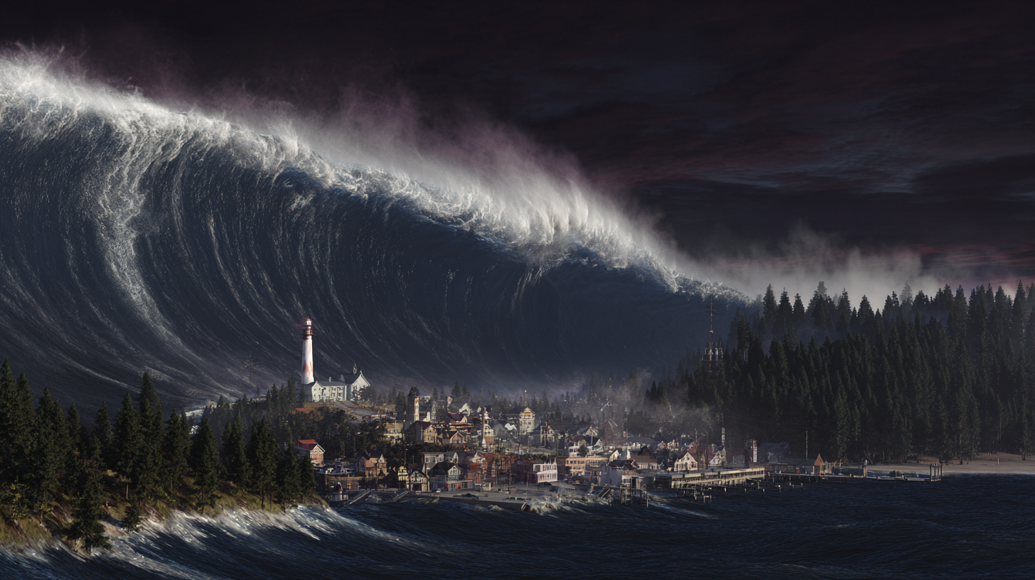
Depending on where and how the fault breaks, tsunami waves between 30 and 100 feet high could slam into the Pacific Northwest coast within minutes. To make matters worse, parts of the coastline could drop by as much as 6 to 8 feet almost instantly. That sunken land wouldn’t rebound. Communities currently safe from tides could find themselves in flood zones, forever.
A 2025 study published in the Proceedings of the National Academy of Sciences by researchers at Virginia Tech found the 100-year floodplain could expand by up to 300 square kilometers after a major Cascadia quake. Entire towns, power stations, roads, and emergency services could suddenly lie at or below sea level. The coastline would change in minutes—and stay that way.

The Pacific Northwest isn’t alone. In 1964, Alaska experienced a magnitude 9.2 quake, the largest in U.S. history. Parts of the coast dropped by up to 8 feet. A resulting tsunami killed more than 100 people and sent waves crashing into California and Hawaii. In Shoup Bay, one wave reached a staggering 220 feet.
And in 1958, Lituya Bay in Alaska was the site of the tallest wave ever recorded. A quake-triggered landslide sent 90 million tons of rock into the bay, launching a wall of water 1,720 feet high, nearly the height of Chicago’s Willis Tower. While localized, it showed how quickly and violently nature can react when the Earth moves.
Hawaii faces its own tsunami risks. While it has no subduction zones, the islands are vulnerable to waves from across the Pacific. Some scientists believe that ancient volcanic landslides on Mauna Loa or Kilauea created tsunami waves hundreds of feet high in the distant past. These events are rare, but not impossible.

This isn’t speculation. These are known threats. Some are modeled, some are measured, and some have already happened.
Communities in Washington and Oregon are responding. Some are building vertical evacuation shelters. Others are reinforcing schools and town halls to double as tsunami refuges. A few are even constructing manmade hills to buy precious feet of elevation. But many low-lying areas still don’t have viable evacuation routes.
Public awareness is critical. The key message: if you feel strong shaking, don’t wait. Get to high ground.
Federal agencies like NOAA and the USGS are also improving early detection. Sea-floor sensors and pressure gauges are being installed to monitor for sudden shifts. But even with the best systems, warning time may be measured in minutes, not hours.

This isn’t about fear. It’s about foresight. The stillness of the ground doesn’t mean safety. It means stored energy. And when that energy releases, the best protection we have is preparation.
The wave may not come tomorrow or in our lifetime. However, if it does, those who have planned will have a chance to survive and rebuild. The land may fall, but the choice to act is ours now.
Leave a comment