Oklahoma City seems unhurried at first glance. Newcomers wander into downtown, pass the sleek glass towers, and pause at the lush Myriad Botanical Gardens. Most of the time, they don’t look down.
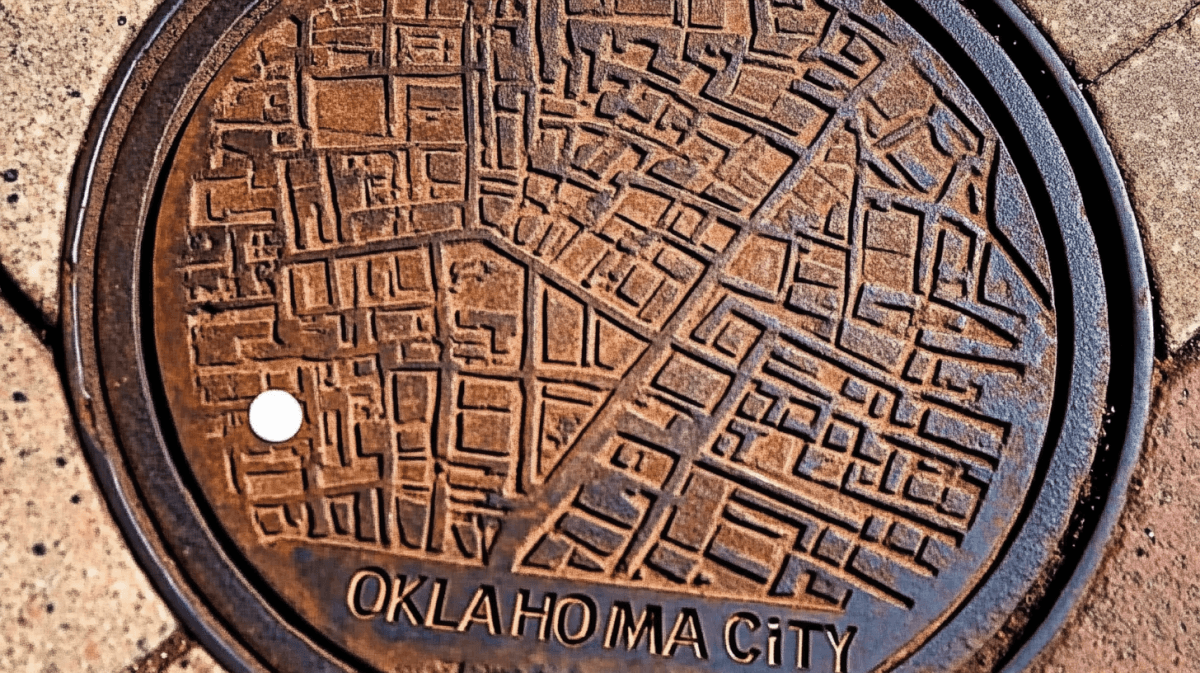
Only when someone points it out do you notice the small manhole covers embedded in the concrete. Each one holds a city map with a single white dot showing where you stand.
You can’t help thinking about the people who set them there. Were they trying to give tired travelers an easier way to navigate? Or maybe they wanted to spark curiosity about a city born from grand plans and historic upheaval.
Some residents, scanning the sidewalk for directions, find these covers more reliable than any smartphone for orientation. Others admit they’d lived here for years before spotting that little dot.
Walking into the past
Stroll a few blocks to the grounds of the Myriad Botanical Gardens. According to an old city record, “The Myriad Botanical Gardens, part of I.M. Pei’s ambitious plan to create an urban park for a renewed downtown, were first completed in 1988.” The gardens offer a soothing green space, with winding paths and a tropical conservatory housing more than a thousand plant species. You might even find another manhole cover there, bearing a clue about the city’s growth and the era of dramatic urban renewal.
Many of these sidewalk markers also nod to pivotal moments in Oklahoma City history, from the so-called “Iron Wall” of railroad tracks that once split the city in half, to the inspiring tale of Clara Luper’s 1958 lunch counter sit-in. In reference to that defining event, one plaque records, “West of this site on April 19, 1958, Clara Luper led 13 African-American youths in the nation’s first lunch counter sit-in at Katz Drugstore.” The city’s story reveals itself block by block, quietly etched into metal plates.
Maps beneath our feet
Not all of these covers align precisely with north, south, east, and west. If you stand on the dot and face the wrong direction, you’ll still see a rough outline of downtown. For some, that’s part of the charm. You hold your coffee cup, smile at the whimsy, and step around the corner, using the sidewalk itself as your guide.
Perhaps these covers are a subtle invitation to slow down. Sometimes, you learn more about a place when you pause to study what’s beneath your feet. A map underfoot can make you wonder what else might be hidden along the route. It can pull your gaze from the skyline to the soil and remind you that history is written at every level, even on a cast iron lid set into concrete.
They’re simple but revealing, and more might be just around the bend. The next time you’re downtown, look down. You’ll see the map, notice that bright white dot, and realize it’s telling you, in its own quiet way, that you’re standing in the center of a place shaped by hope, struggle, and reinvention.
Leave a comment